Talk Ultra

20120129-163638.jpg

Wow, it has been a really hectic few months and blogging has been put on hold. The reason? Well, Talk Ultra.

I have been trying to get an ultra running podcast off the ground for the best part of 12 months. Suddenly, in September/ October 2011 it all started to come together. My good friends at Martahon Talk, Martin Yelling and Tom Williams confirmed that the expansion plans for the MT brand was going to go ahead and therefore finally I was in a place to get Talk Ultra off the ground.

I contacted Ian Sharman, fellow Brit who now lives in the USA who happens to be a pretty darn quick ultra runner. He burst onto the ultra scene in 2011 with a stunning 12:44 at the Rocky Raccoon 100 miler. He was a great choice as a co host. Great runner, respected athlete and a good communicator.

Key aspects of a new podcast had to bring something new to the arena. I had plans up my sleeve and I am pleased to say that they have all come together and appear in episode 1 of the show.

Firstly is a key interview with a star or notable celebrity in the sport. Episode 1 has South African, Ryan Sandes. Episode 2 has Western States creator, Gordy Aisnleigh. Episode 3, New Zealand runner, Anna Frost and so we have set the scene for a great show format.

I contacted Ultra Legend Karl Meltzer and asked if he would do a regular slot on the show. He agreed! Speedgoat Karl will now be on every show in a ‘Meltzer Moment’ talking about the Good, the bad and the ugly of the sport.

In order to appeal to the masses, I also wanted to include a section that gave ‘every’ listener the opportunity to be a guest on the show… This is called ’15 mins of fame’ and we encourage you all to nominate and recommend anybody. We have no criteria other than that the person should have achieved something special within ultra sport. This maybe something for charity, running a first ultra, maybe running 50 ultras or maybe just doing that ‘zone thing’ that stands out from the crowd.

Ultralegands is a look at the history of the sport. Phil Essam from Australia will provide a regular 5 min slot looking back at how ultra started and key moments in the sport.

So, it is an exciting time. Each show will be released every two weeks and episode 2 will be available on Feb 10th.

As I write, episode 1 has been available for 48 hours and we are absolutely blown away with over 3500 downloads. Incredible.

I value your feedback and your support so please contact me.

You can download the show here:

SHOW LINK

RSS feed
http://talkultra.libsyn.com/rss

iTUNES
http://itunes.apple.com/gb/podcast/talk-ultra/id497318073

Many thanks and don’t worry. I will be back with regular posts!!

Yours in sport,
Ian

Endurancelife Stage 1 – Northumberland

Sunrise on the Northumberland Coastline

The long awaited Stage 1 of the 2011/2012 Endurancelife Coastal Series finally arrived with a new course and a new venue on the Northumberland Coastline. This is a coastline that I have very little knowledge of and so once again, Endurancelife enabled me to fulfill a couple of things that I always like to do when I do a race, see a new place and run somewhere different and challenging.

I hadn’t actually realised how close to Scotland our race venue was. Bamburgh Castle was literally not much more than an hours drive from Edinburgh. Unlike the other races in the Coastal Series, this coastline was more gentle. What it lacked in up and down coastal paths it made up for with Castles, beaches and stunning views.

It was an early start to the day, but then again, this is nothing unusual when racing. Niandi and myself arrived at Bamburgh just in time to see the sun break the skyline and provide us with an orange glow in the early morning chill. It was quite a start to the day. Andrew Barker from Endurancelife was running around taking photos and capturing video while other EL staff prepared registration and all the last min prep that goes into a race, or should I say races of this size and nature. What has always been a great feature of EL races is the provision to provide distances of varying nature, 10k, half marathon, marathon and now ultra. Of course, if you have raced any EL race before, you know the 10k is 12k, the half is 14 miles, the marathon is 28 miles and the ultra, well, the ultra could be anything…. you always get value for money! And I mean this in a very positive way. Trail racing is never an exact distance and we never want to be cheated.

The Northumberland race in many ways was a unique event. This is the one and only ‘point to point’ race in the CTS and therefore at 0800am the marathon and ultra runners were transported by coach some 30 min away to the race start at Alnwick. Our obective was to run from Alnwick, back to the coast and then run north up the coastline back to Bamburgh Castle.

Endurancelife, Northumberland Marathon route

As you will see from the above map, Alnwick was inland and it provided us with quite a beautiful start. It became apparent early on that our day was going to be a ‘good day’. The sun was out, skies were blue and the early morning chill was going to soon disappear and provide us with a warm and clear day for a great run. We grouped together in a field while Gary from EL provided us with our usual pre race briefing. The route was pretty simple; run to the coast, turn left and run north until you reach Bamburgh Castle. Of course, no route is that simple but EL always do a great jog of marking the route with red/white tape or white chevrons painted on the floor (eco friendly paint) or objects to help navigate the runners in the right direction. Of course you need to pay attention and keep your eyes peeled, after all, following the route is actually part of the event.

Alnwick Castle - race start

At 0900 we were off and an early group soon formed with  guys up front, myself and Oliver Sinclair in 4th and 5th and then a couple of other guys close behind in 5th and 6th. The early trail was mostly through fields, farmland and woods. We had the early joy of wading through a river up to our knees. Perfect! completely wet feet in the first few miles of a marathon. I actually didn’t mind. To be honest I found the chill from the water nice on the muscles. Today I was running a little cautious as the previous weekend I had raced a 50k. The five days after that race had been devoted just to easy runs of 4 miles twice a day with the emphasis on loosening my legs rather than training.

The six of us pushed to the coastline, as I looked around at the race numbers I was surrounded by 5 ultra runners and I was the only marathon runner. A nice position to be in. In principal the ultra runners should be running a little slower than the marathon runners but considering I had no competition around I had no reason to run any harder.

After about 45 min we moved from a road section, crossed a bridge and we were then on the coast. Oliver Sinclair lifted the pace slightly, Andrew Bass followed and I basically maintained 3rd place maybe some 100m back.

As we hit the coast we had a mixture of terrain; sand, road and grassy trails. Because of the mixed nature of the terrain I had decided to use a new pair of Hoka One One shoes called ‘Stinson B Evo’. These shoes are actually only going to be available in 2012 but it was important for me to start testing them so that I could provide feedback. Unlike other shoes in the Hoka range these shoes offer increased grip, a race fit and obviously the supreme cushioning that Hoka offer. EL races always offer challenging terrain, not only for the lungs but for your feet, so, a good pair of shoes is a must. I have to say, that the Stinson B Evo is going to be a great addition to the Hoka range.

Hoka One One - Stinson B Evo

As we moved up the coastline Andrew Bass had taken the lead followed by Oliver Sinclair and then myself. The 4th and 5th placed runners had run with me for a short while but as we hit the dunes and mixed terrain we had all found our natural place. I could still see Oliver and Andrew but behind me was nobody, so I settled and concentrated on keeping an even pace. I went through the 2nd checkpoint at around 1040 am, this would mean that I was about 10 min behind the Half Marthon runners who started at 1030am.

Ian at Northumberland

The sun was out and it was getting pretty warm. As we ran past our second Castle of the day, Andrew was waiting with his camera at the ready. This section was tough underfoot. You needed to look at your foot placing. Ok, excuses over. Question? Is the above photo concentration or do I really look wrecked?

Wrecked or not I was leading the marathon and in 3rd place overall behind the two ‘ultra’ guys up ahead. As we moved on we now had sections of coastline, long stretches of beach and back markers from the half marathon race ahead. At the 20 mile mark I went through a bad patch…. I could feel some fatigue from the previous weekend and had to dig deep to put the ‘walk demons’ away and keep the tempo going. On the beach sections I cut the lines as best as I could looking for the shortest line. Happy to get my feet wet if meant I saved on distance.

At the final checkpoint Bamburgh Castle was in view and as I shouted ‘about a mile to go?’ the marshall said ‘erm no!’ Aaaagh, this is when the EL value for money kicks in. On those days that you want the marathon to be 26.2 you just know it is not going to be. Endurance running is as much about the mind as the body and when you think your finish is less than 10 min way but then soon realise that actually it is probably going to be more like 30 min away, you need to recoup, dig in and push on.

The final beach section was a long one. The terrain was good though, yes it was softer tan trail but it wasn’t deep sand. Finally the foot of the castle came and we had some nice twisty dunes to navigate our way through.

A mile to go in the dunes

Out of the dunes we had a climb up to the castle a right turn and then a couple of hundred meters to the finish. A great finish awaited with the castle making the perfect setting. I made the total distance covered just short of 28 miles and my time was 3:46.

In summary this is a beautiful course and it is extremely runnable. It is a great first event for those moving to trail racing or those tempted by the EL series of Coastal Races. My buddy and team mate, Oliver Sinclair won the Ultra so it was a great day out for the Endurancelife Team.

The finish - Bamburgh Castle

Nottingham Ultra 50k

As you will know, both Niandi and myself took a good beating at the Trail du Mercantour in September. With Nottingham Ultra landing exactly three weeks later, my plan was to rest and recover, do a little training and go to Nottingham ‘fresh’ but a little under trained.

I actually took a full 10 days rest. I really felt as though my body and my mind needed that break. Mercantour had twisted us and bashed us like no other race. Considering we had also used our Hoka One One shoes, I dread to think what I may have felt like had I not used them!

I started back with a few 4 mile runs and then at the weekend did a 10 mile trail and 12 miles on the road. All pretty easy paced. I felt sluggish and I also could still feel some ‘deep’ fatigue that I needed to get rid off. Race week was easy and then 3 days before the race I went out on the road and ran 8 miles tempo, finally, some two and half weeks after our French race I felt as though some zip was coming back. I purposely then took two days rest and arrived at Nottingham with Niandi feeling fresh.

Course Profile

The race was primarily off road running in the steps of Robin Hood from Sherwood Forest to the cobbled streets at Nottingham Castle and the statue of Robin Hood. Checkpoints and feed stations where placed at approximately every 10k and the route was marked by stickers or yellow arrows sprayed onto the ground or trees.

From the off a group of us moved to the front and within 3 to 4 miles the race was strung out. Two guys up front by 20 or 30 seconds, one guy in the middle and then myself and another guy in 4th or 5th.

Coming into the first check point the positions stayed like this but as naturally happens and feed stations the order changed. I didn’t stop at all as I was running very much self sufficient. I had a bladder and 2x 500ml bottles and ‘shot blocks’ for energy. My plan was just to keep pushing and not loose momentum.

Coming into check point one


As the course twisted and turned it was really important to keep your eye on the markers. Don’t get me wrong, the route was really well marked but it was easy to miss a waypoint if you just kept your head down too long.

Arriving at a golf course the markers suddenly disappeared. Now running 3rd/4th place the time wasted looking for an arrow allowed the 5th runner to catch us. The three of us looked left, looked right and then suddenly saw a glint of yellow that would take us around the golf course. A sudden screech and a quick turn around saw one of my fellow runners go over on his ankle… I had done almost exactly the same minutes before but had run it off knowing that I would probably have some swelling and pain the following day. He had to ease up and once we had checked he was okay pushed on.

It was becoming apparent that the early pace was now causing my running partner some trouble and without accelerating away from him he slowly drifted off my pace. I had now moved up into 3rd place but when I arrived at checkpoint three I was told I was in second place some 7 minutes off the lead guy.

Priority now was to hold pace and maybe try for a late push. It seemed unlikely that I would reel back in 7 minutes but it is so easy to have a bad patch. Throughout the event, a MTB rider had been going backwards and forward between the fron of the field. He didn’t provide updates but it was good to see him as it always confirmed I was on the right track. At one of the many gates, I looked back to see a runner who had moved up through the field who was now in 3rd place. I think at this point I had possibly slowed unknowingly allowing him to move up to me. As we pushed on I felt his presence and not wanting to be a carrot I eased up, let him past and decided to have a role reversal. The weather now was pretty warm and this guy was running in tights, long sleeve top and t shirt over the top. He made me feel hot!

In the final sections of the race I had pegged him all the way and when I noticed his pace start to drop I put a hard effort in and pulled away only to arrive in Wollaton Park, with no markings. Looking around it wasn’t clear of the direction to take. He came back to me and then we saw a runner who pointed the direction to take. I ten pulled away again aonly to find that at the next junction we had no clear markings again. I was wasting time now and when you are in 2nd place that is just no fun!

I branched left, 3rd place followed me. I was half committed as I was unsure I was taking the right direction. Looking over my shoulder I saw 4th place runner taking a different direction. I turned, ran hard across the park and pulled my up to him. Now 5th and 6th place had joined us and it was becoming beyond funny. Nobody knew the direction to take and so we looked at the map and decided on a route. It was wrong!

My second place now become an 8th and I think the 9th place runner had come through and moved up to 2nd.

Bit between my teeth I started the chase but I was running on frustration and at 28/29 miles into a race you just don’t have that ‘spare’ resources to run hard. Out of the park around some road works and on to the canal. I had moved back up into 4th with 3rd in sight but probably a minute away. With just over a mile left I couldn’t pull it back. I arrived at the Robin Hood statue on reflection happy with my 4th but frustrated it wasn’t 2nd.

Hoka One One – 2012

Hoka One One shoes utilize a unique rolling motion to deliver superior underfoot performance. Featuring a 50% rocker profile, Hoka One One help provide an excellent stride transition. It propels you forward with every foot strike.

Hoka One One are the only shoe to utilize oversize technology. Using up to 2.5x the EVA volume in the midsole in comparison to conventional running shoes. Offering outstanding impact absorption they allow you to run natural irrespective of the terrain.

Your foot sits within the sole in a unique patented bucket design which is recessed between 20 to 30 mm into the midsole. This allows for precision striking and optimum stabilisation of the foot. Importantly, this bucket allows for for excellent responsiveness despite the high level of cushioning.

What is also key across the Hoka One One range is that they utilize a wider footprint. In comparison to normal run/ road shoes this platform is 35% wider. This profile works to counter the increased height but also to add confidence and increased grip to every foot strike.

The sole of the shoes are designed to synchronise with your terrain and as such, Hoka One One have developed a series of shoes so that you  have the right shoe for your chosen terrain. The midsole is also designed with grip in mind allowing for the correct amount of deformation so as to provide constant contact with the ground.

The 2012 Range

The Hoka One One shoe range has taken a firm hold in 2011. In 1 year, they have featured in 8 Countries with 17 major victories.

Diana Finkel 2010Hardrock 100 Karl Meltzer Massanutten 100, Pony Express Trail, 2064 miles Dave Mackey 2011 Miwok 100k, 2011 American River, 2011 US Trail Championships, Bandera 100k Christophe Le Saux Sahara Raid 200k, 2011 Australian Outback 540k, 2011 Gutan Trail 200k,, 2011 Guadrun 150k, 2011 Tour des Giants 2nd place….. and so on, the results keep coming!

For 2012, the shoes will undergo some tweaks and minor adjustments based on feedback from runners and as an ongoing development of the shoes and brand. 2011 saw the introduction of the Combo XT (Stinson in the US) and it is this shoe that has been developed into a new shoe for 2012, the Stinson B Evo.

BONDI B

Bondi B is the road shoe in the Hoka One One range and is ideally suited to ultra runners, marathon runners and triathletes who want to push endurance boundaries. Ideal at reducing impact, shocks and lessening fatigue. The Bondi B also works exceptionally well on hard and compact trail. In principal, the shoe remains unchanged for 2012 with one exception. Sizing has beed tweaked and the Bondi B will now ‘fit’ inline with all shoes in the Hoka One One range. I recommend that if you are not already a Hoka One One user you should size up by a 1/2 size from your current run shoe.

Price – £130 plus postage and package

Ordering and colour options:

Pre Orders for 2012 will be accepted on completion of an order form. No payment will be required until stock has been received in the UK. Delivery is expected March 2012.

Colour Options:

Limited stock and special orders are available for the Unisex white/citrus/cyan ‘branded’ with Hoka One One on the side. This is a statement shoe. I definitely recommend pre ordering of this colour way.The standard unisex shoe for 2012 will be available in sizes 4.5 UK to 12 UK in citrus/silver/greyThe Mens shoe (or unisex if your foot size is larger that 7.5 UK) will be available in 7.5 UK to 13.5 UK in anthracite/orange/white

Bondi B is still available at anytime in 2011 colours and size (please go 1 full size up from your current run shoe if it is not a Hoka One One)

STINSON B

Stinson B is currently named ‘Combo XT’ in the UK and will be renamed for 2012 to fall in line with naming in the rest of Europe and America. The shoe has no changes, other than colour for 2012.

Ideally suited for runners who love to mix road and trail. The Stinson B offers great comfort over mixed terrain, a breathable upper and a tough sole for increased durability and traction. This shoe in 2011 has become a ‘best seller’ for runwildrunfree. Clients have seen the benefits of it’s go anywhere attitude, increased comfort and it’s ability to leave you fresh from repeated running or racing. Sizing will fall in line with all shoes in the Hoka One One range and if you are new to Hoka One One, we recommend a 1/2 size larger than your current road/trail shoe.

Price – £116 plus postage and packaging

Colour Options:

Stinson B will be available in 7.5 UK – 12 UK in blue/silver/orangeA darker colour option and larger shoe size will be available in black/anthracite/lime in sizes 7.5 UK to 13.5 UKIf you require a smaller size from 4.5 Uk, we will be offering the Stinson B in white/silver/citrus as special order only

Ordering is possible by emailing ian@hokaoneoneuk.co.uk and requesting an order form for 2012. The current Combo XT model is still available at the 2011 price of £99.

MAFATE 2

Mafate 2 has been reworked for 2012. Designed for the most demanding off-road running the Mafate 2 has been constructed around grip and support. The outsole has been overhauled to provide a deeper 4.5mm lug profile, it has enhanced grip and increased abrasion resistance.

The upper has been re-designed offering high support construction for a precision fit and the lacing system has also been tweaked to help improve fit. The Mafate is how Hoka One One started and is the benchmark from which all Hoka One One shoes have been based. Oversize technology, rocker profile, great comfort, increased foot print and the ability to run on all terrain and maintain a high pace.

Price – £126 plus postage and packaging

Colour Options:

Mafate 2 will be available in citrus/anthracite/white in sizes 4.5 UK to 12 UKA darker colour option with larger sizes will be available as a special order only in anthracite/white/orange in sizes 7.5 UK to 13 UKOrdering is possible by emailing ian@hokaoneoneuk.co.uk and requesting an order form for 2012.

STINSON B EVO

Stinson B Evo is the new addition for 2012. A development from the Stinson B (Combo XT) it is designed for absolute racing performance. A new lightweight and highly breathable upper encloses the foot, holding it firm with a new ‘speed lacing’ system (conventional laces supplied). The outsole has been re-designed offering greater grip on trail. It has high abrasion EVA lugs to improve on weight without sacrificing abrasion resistance. The surface profile has been altered to provide enhanced grip on challenging terrain such as wet rocks, mud and when going uphill. Equally, it transfers from trail to road seamlessly. Stinson B Evo also features an ortholite insole that improves comfort through its breathability, anti-bacterial properties and the fact that it will not compress over time.

Price – £136 plus postage and packaging

Colour Options:

Limited stock and special orders are available for the Unisex white/citrus/cyan ‘branded’ with Hoka One One on the side. This is a statement shoe. I definitely recommend pre ordering of this colour way. Available in 4.5 UK to 12 UK

The two main colour ways for 2012 will be the unisex citrus/black/cyan available in 4.5 UK to 12 UKThe Mens shoe will be available in anthracite/citrus/black in sizes 7.5 UK to 13.5 UKA blog post with photographs on the Stinson B Evo is available here: https://iancorless.wordpress.com/2011/09/30/hoka-one-one-stinson-b-evo/

The above review is a little more in depth and the photographs show in detail the benefits of this new shoe.

All 2012 stock will be available from March 2012. I have been informed that 2012 stock will be limited and therefore if you have any special needs or requirements I strongly recommend pre-ordering. No payment will be required until your chosen shoes arrive in the UK and are available for postage. Please email ian@hokaoneoneuk.co.uk for an order form or if you would like any additional information.

Current 2011 stock is still available from http://www.runwildrunfree.co.uk and moving forward, all shoes orders will be taken via this website using PayPal as means of payment.

Hoka One One – STINSON B EVO

Hoka One One is the brainchild of two gravity sports enthusiasts Jean Luc Diard and Nicolas Mermoud. Both men have been adventuring as long as they can remember and their trail running experiences have taken them across the globe. They quickly came to an important conclusion; fatigue, impact and muscle strain were challenges that runners of all stripes had to deal with. So, Jean Luc and Nicolas came up with a brilliant idea, why not design a shoe that would help to alleviate these problems.

This week I was fortunate enough to spend some time with Steve Couper from Sidas and go through the new Hoka One One range for 2012. Needless to say, this was a real bonus. After some discussions with Steve and Nicolas, I was aware that the 2012 range had some significant changes and importantly, a new shoe.

First thinks first, the new shoe!

STINSON B EVO

Wow – first impressions are stunning. Steve had all the colour ways on display of this new show but your eyes to go straight to the Unisex show with the bright and bold Hoka One One written on the side of the shoe. The white/Cyan/Citrus colours stand out and just draw attention.

The Stinson B Evo is designed for racing performance and as such is designed around precision and flexibility. The new outsole design includes high abrasion EVA lugs to improve on weight without sacrificing abrasion resistance. The surface profile, as a whole, has been altered to provide enhanced grip (in comparison to the Combo XT/Stinson) on challenging terrain such as wet rocks and mud as well as providing greater uphill traction.

Stinson B Evo sole

The upper has been optimised to provide a precise racing fit and this shoe feels much more streamlined with improved forefoot hold. The upper is also considerably more breathable, it balances all aspects of weight, support and breathability perfectly. There is a pull-cord quick lace system for rapid adjustment (conventional laces also supplied). The midsole which includes a new contoured sidewall synchronises perfectly with the 25mm recessed misdsole. Finally, the Stinson B Evo includes and ortholite insole which improves comfort through its breathability, anti bacterial properties and the fact it will not compress over extended use.

Technology

The Stinson B Evo provides off road racing performance thanks to an enhanced sole and ‘rocker’ profile. The rocker profile creates a smooth energy efficient stride transition. As with all shoes in the Hoka One One range, the Stinson B Evo uses oversize technology with 2.2x the EVA volume of conventional run shoes. This ensures high impact resistance, a smooth underfoot feel and importantly, this enhanced sole allows you to run over mixed terrain in much more comfort allowing you to keep the pressure on and the pace up. Your foot actually sits ‘within’ the sole in a ‘bucket’, this allows for an unparalleled level of  control. In addition, the new grooves in the sole allow for enhanced flexibility.

Colour Options & Stock

The two main colour ways that runwildrunfree will stock for 2012 will be Citrus/Black/Cyan and Anthracite/Citrus/Black.

Citrus/Black/Cyan - Unisex

Anthracite/Citrus/Black - 7.5UK to 13.5UK

In addition to the above, I will have available for PRE ORDER ONLY the limited edition White/Cyan/Citrus with the ‘Hoka One One’ branding on the side. This is a real ‘statement’ shoe and as such will be the shoe to be seen in come 2012.

White/Cyan/Citrus 4.5Uk - 12UK

Sizing? If you currently use either Mafate or the Combo XT in the UK we recommend that you order the same size. If you are currently using the Bondi B, we recommend a 1/2 size smaller. If you are new to Hoka One One, we recommed that you size up by a 1/2 size.

Ordering? I will take pre orders on all shoes and colour ways with an expected delivery in March 2012. I not require advance payment until the shoes arrive in the UK, however, I will require you to complete an order form with a £25 deposit.

Contact? Please email me at ian@hokaoneoneuk.co.uk

Stock? UK stock of all Hoka One One shoes in the first six months of 2012 will be limited. I therefore strongly advise you to avoid disappointment by acting in advance.

Price? £136 plus recorded postage (please remember that Hoka One One shoes last considerably longer than conventional run shoes, 6-800 miles)

Elsecar Skelter, August 13th 2011

Niandi returned from her weekend in Paris and congratulated me on what turned out to be a joint 2nd place at the Dovedale Dipper in Derbyshire. It soon became apparent that as I talked about the event; the course, the low key nature, the organization, the feed stations and basically what a great event it was, Niandi wanted the buzz too! So, armed with the LDWA book I found the Elsecar Skelter – a 27 mile challenge over a trail route in Yorkshires finest countryside.

The event had a start of 08:30 but the we where only about an hours drive away so our typical 06:00 start was no hassle. The HQ was in the center of Elsecar, The Market Hotel which was just next to the Heritage Center. As with all these events it was very low key. Plenty of friendly faces and everyone willing to help. We picked up our packs and the ‘route book’. Wow, the route book… it was like War & Peace. Niandi looked at it and felt instantly ill.

“When you said navigation, I thought you meant just following signs” exclaimed Niandi “well, you are going to have to run with me as I can’t run and follow that!”

I wasn’t worried. I was looking forward to today being an opportunity for Niandi and myself to run together and also for me it was more miles in the legs. I was happy for those miles to be easier than the previous weeks marathon at Dovedale. On the start line serious looking runners looked each other up and down. Yorkshire breeds a tough, hardy runner and we were surrounded by them! At the ‘off’ two lads sped away looking as though they meant business… within 50yds they missed the first right turn. It was going to be a long day I thought. As I made the turn with the two other guys ahead going straight on, I questioned if it was myself that was wrong? Never good when you still have 27 miles to go. However, reassuringly I was correct. Importantly, you must always do your own navigation. Make your own mistakes and don’t second guess the decisions.

Early pace was relatively sedate as we ran up narrow single track, climbed over a stile and then ran through some open fields.

We soon had a small road section, past Cottages, over another stile, through a field and then entering a wood. It was very easy to go wrong but the route book was very well written. It was clear, informative and descriptive. The only issue is when you are trying to move at spped it is difficult to run, read and navigate without missing something. We passed ‘Hoober Stand’ – a 30m high building on a ridge situated in the village of Wentworth. The building designed by Henry Flitcroft was built to commemorate the 1745 quashing of the Jaccobite rebellion (http://en.wikipedia.org/wiki/Hoober_Stand). So, now you know…. it made a nice backdrop for Niandi as she ran past.

Running through Hoober Village Niandi and myself were pretty much running on our own. In the distance we could see one runner. Ahead of him just 2 or 3 others. Running up we came to the brow of a hill and the village of Nether Haugh. Navigation here became a little more complicated…. ‘bear right on tarmac track and take path left of house number 19, go forward (hidden mausoleum on right) on path to corner of field and turn left keeping hedge on right’

As you can see, very descriptive instructions and in most cases very reassuring. Any mistakes could soon be corrected relatively quickly. However, even though I ‘thumbed’ the route it was easy to jump a sentence and then I would find I was ahead of myself and starting to question if I was right. It all comes down to practice, the more you do the better you get. Wentworth Woodouse was in view, a stunning grade 1 listed country house (http://en.wikipedia.org/wiki/Wentworth_Woodhouse)

The first check point came. We had our cards clipped, drank juice, picked up a snack and then we were off. After a section of trail and fields we entered an industrial estate and stupidly I followed the direction of one lone runner in front. After 3-400m I realized we were wrong. As we back tracked I saw one runner turn where we should have turned. Back on the trail we were running uphill when suddenly a group of 4 caught us and ran past…. despite this being training I always find this difficult. I am far too competitive! But I behaved. Needless to say Niandi would not have been too happy to see me get the bit between my teeth and head up the trail…. At the top of this section a group of approximately 6 of us looked at each other; we were all wrong. We had missed a path off to the left lower down. A ‘local’ guy who obviously knew his way around went off piste and we followed, over the brow and running through a field and checkpoint 2 was in front of us. Another banquet. This checkpoint would be visited again much later in the day when we ran our figure of 8 loop.

This next section between checkpoint 2 and 3 was the toughest of the route. It had plenty of open rutted fields, gnarly ground, corn fields and thick overgrown vegitation. Believe me, both our legs have the scars to prove how tough this bit was. Navigation was also a little difficult but we managed (just about). We also had a ‘self check’ checkpoint on this route just to ensure no cheating took place. Liked that idea! The course really was a surprise. It was beautiful, tough and the weather was kind. What more could you want. After approximately 13 miles covered checkpoint 3 came and with it the option to take the shorter 20 mile route or commit and go for the 27 mile option. I could see some hesitation in Niandi and when we were asked “20 or 27?” the very quick response from myself came “27”. Pretty sure Niandi thanked me for that decision later in the day….

As we left I immediately went the wrong way. Apparently we needed a ‘supplement’ to the road book for the 27 route. Luckily I had this! Somewhere… !?! Back on track we headed off with the riniging voice of one of the marshalls saying

“This bits tricky…. easy to get lost… complicated… watch out at Dragons Den….”

OMG – Dragons Den… what are we running into? We ran down a path, through a stone yard, over a stile, ran across a field and then ran up a grass bank to meet the road and a left turn. Down the road I looked for a bungalow which apparently our ‘path’ was opposite. Mmmmm apparently not! Aaagh – that bungalow – you mean the bungalow that doesn’t look like a bungalow… ok.

Now in moorland we headed towards the sklyline and a power pylon. The path stopped, a stile was in front of us but the route book didn’t say ‘go over’ the stile. Another runner came. He was local and very well experienced on the course… he had ‘given us the nod’ once or twice before! We chatted and tried to decide on the route. I took the stile and ran on whatt was a definite path. After 5 mins or so it just didn’t feel right. I retraced and did what is always the best thing to do in these situations, go back to the last place you know is correct and then re navigate.

I was back on the track and then we had a ‘self check’ point at Dragons Den. All made sense now…. those marshals new that this area was open to going wrong. Wharncliffe Crags – wow!!! This section of rough tough trail was absolutely fantastic, Tough underfoot, great views and stunning.

The edge which is characterised as a steep rock face for much of its four kilometre length runs from just east of the village of Deepcar in a roughly south easterly direction to just east of Wharncliffe Side. Wharncliffe Crags stand on the eastern side of the upper River Don valley at a height of around 250 metres above sea level with the highest spot height being 297 metres.

Here is a little clip of me running at full speed on my way down to the edge of the Crags. Needless to say my Hoke One One Combo XT helping to remove all the harshness out of the terrain.

After a short section of forest we now re joined the original route book and our ‘detour’ to build the mileage for the 27 mile option was over. Running uphill we arrived at Wortley Church.

Passing trough a metal gate, we turned right, crossed the road and entered the grounds for Wortley Hall (http://www.wortleyhall.org.uk/) The hall is a stunning location, a beautiful building set in beautiful grounds. Waiting for us here was the ‘famous’ checkpoint 4.

All the feed stations in this race were superb but ‘4’ was the icing on the cake! The walkers would certainly be able to benefit from the spread on offer… i grabbed a jam tart, or was it two? Niandi was her usual restrained self, body is a temple and all that and took a whopping piece of chocolate cake!!!

It was the home run now and feeling refreshed from the joys of checkpoint 4 we pushed on. We now began to retrace some of the route from the earlier part of the day. Fields, gates, paths and routes had a familiarity. It was reassuring. However nothing looks the same when running in the opposite direction. From here on navigation was relatively easy. I had taken on the tactic of running ahead, stopping, naviagting, waiting for Niandi and then pushing on. We ‘self clipped’ at checkpoint 4a and then had a really great section of forest before suddenly arriving at checkpoint 5 (this was the same checkpoint as 2 from earlier in the day). Up the hill, over the bridge and now climbing up through more trails and then a fast run down past a golf course. We then joined a road opposite Tankersley Church, turned right and then ran past Tankersley Old Hall (http://www.wildyorkshire.co.uk/naturediary/docs/2001/9/7.html), famous as this was featured in the classic film ‘Kes’ – http://www.imdb.com/title/tt0064541/

After the Hall we took a path left and the final checkpoint, a ‘self clip’ set in a wooden pathway was ahead of us. We now ran the final miles at a good pace. Navigation was easy and the terrain was good underfoot. After a few miles we came to a reservoir. We ran around the reservoir, through a park, past a bandstand and then suddenly we were back! 28.5 miles in the bag.

Back at the race HQ both Niandi and myself were told that we had made top 10. A good result considering a definite lack of pace due to the navigation. However, the result was not important, we had both had a fantastic day out on a stunning course with brilliant organization. At the finish we even had the treat of a finishing certificate, a ‘sew on’ patch and a meal of ‘Pie n Peas’ – a delicacy for Yorkshire. Have to say the pie went down really well…. nothing like creating a hunger with a long tough run. Of course I could feel even more smug….unlike Niandi I hadn’t had a whopping piece of chocolate cake at checkpoint 4!!!!

Dovedale Dipper August 7th 2011


The Dovedale Dipper is a ‘challenge’ event organized by Matlock Rotary Club offering a  15 mile walk or a 26.5 mile run over a circular route in the Derbyshire Peak District starting and not surprisingly ending in the village of Hartington.

This years edition I believe was the 9th running of the event and I have to say that Matlock Rotary Club did a great job. Superb planning, a great ‘route book’, great check points with a really good selection of food and liquid and at the end some hot food and drink. What more could you ask for? I certainly feel the ‘on the day’ entry fee of £15 (cheaper if entered in advance) was money well spent.

To be honest, on the Friday before the event I knew nothing about the event never mind the fact that I would be taking part. One of my coaching clients had sent me a text, told me it was local and that it was a tough and beautiful course. It all sounded too good to be true. I had a free weekend as Niandi was in Paris returning Stanislas after her week long brthday…. my training plan had me scheduled for a long run close to marathon distance, so it was logical that I turn up and run a new course with company.

Hartington Village Hall was full of people on my arrival. As I had walked to registration I had already seen plenty of walkers heading out on the route looking to get some early miles in the bag. The official challenge walk of 15 miles started at 09:30 and then the full challenge of 26.5 miles started at 10:00. Difficult to say how many took part but at least 150 in the main event.

At 10am we set off and the early pace was very sedate. The route book was very detailed and with having no knowledge of the route I held back and looked for the ‘locals’ to set the pace. Within a mile it was clear that one or two front runners knew the route. I quickly found myself in 2nd place following the eventual race winner, Gary.

My plan was to run this event sensibly and not ‘race’ it. Within 2 to 3 miles I settled into my pace and let Gary slowly pull away. I had him in sight for the next few miles so I had a carrot to follow, however, I soon had company with Del Salt (http://delsalt.blogspot.com) and Sean Ketteridge.

I was in good company… very god company. Both Del and Sean are very experienced ultra runners and Del has represented GB.

The first checkpoint came at Sparlow after 5.5 miles. Sean and myself arrived and we were quickly followed by Del. This actually turned out to be pretty much the format for the whole race. Sean and myself happy to run and chat, Del would sometimes surge away, come back and then when the road went up would fall back slightly. Del however new the route and this was invaluable. Sean and myself every now and then found ourselves stood looking at the route book only to have Del come past and lead the way. It soon became apparent that the most logical thing was to run together. Certainly it was a decision I made. The pace for me was spot on, about 1 min slower than race pace and I also feel that Del and Sean had similar thoughts to me.

This is the Peak District and the race is called the Dovedale Dipper, so, it was inevitable that some hills would soon appear. Funny wahen you look at the GPS data as the first 7-8 miles look all uphill but it didn’t feel like that; maybe fresh ‘ish’ legs?

Checkpoint 2, Longnor was not far away but we had a nice climb to get over first. Walk/ jogging to the summit we then ran down to Warslow. In-front was the infamous Ecton Hill. I now say infamous as I have experienced it and of course heard everyone else moan about it.

Our group of 3 remained together and we pushed onwards. Great views at the top but we didn’t have time to hang around. Back on pace we pushed taking turns at the front. Over Wetton Hill and then the 4th checkpoint came. A couple of cups of juice and some calories and we were off.


Traversing over Castern Wood we had some great views. I was feeling really comfortable and the decision to run as a group was really paying dividends. We all pushed a little keeping each other honest but not so hard that we were hanging. When we split up we always reformed. It wasn’t a concious decision but our paces were so similar that this just seemed to be the natural pattern of events.

The terrain for the whole route was generally good with a great mix. Grassy fields one minute, worn trail the next, rutted rocky paths and of course hills; plenty of hills. I was using a new shoe from Hoka One One called the ‘Combo XT’. This new addition to the Hoka range combines the trail Mafate and the road Bondi B and ‘combos’ them into this shoe. I have to say I was 100% impressed. Great grip and a plush comfortable ride over the multitude of different terrain that the peaks had to offer.

Combo XT by Hoka One One

We had a tough rocky and slippery decent to Milldale and the next checkpoint. In the valley we lifted the pace. Flat stony trail suddenly provided a platform of consistent running. Sean and Del lifted ran strong and I hung back a little trying to decide if I wanted to run this quick in the latter stages of a long run. I guess ego took over and I decided yes. Having spent the best part of 21 miles with these guys I wasn’t prepared to let them go. I knew when it came to the finish we would all be together with the same time and that seemed appropriate after a full days running.

Along the valley floor Del told us we had a kick in the tail. The short sharp shock of Beresford dale. It is a short steep climb that we power walked and then once over the top we re lifted the pace and ran down the longest road stretch of the event back to the Village hall at Hartington.

Gary had arrived some 15 minutes before and we arrived in 4hrs 02m all in joint 3rd place.

Great day out. Great course and a real pleasure to run with Gary and Del.

Big thanks to Matlock Rotary Club for a superb and friendly event with excellent organization, checkpoints and support throughout.

Lakeland Trek

THE LAKELAND TREK

I actually posted this Blog in 2010 but with Lakeland 50 and 100 races taking place last weekend, one or two people have asked me to re-post as they are thinking of doing the race in 2012. This blog covers much of the route but not all. I have another blog which I will also re-post that covers a recce day I did of the first 32 miles of the ’50’ route. Here: http://runwildrunfreeuk.blogspot.com/2010/06/lakeland-50100-recce.html

Photos here:http://picasaweb.google.com/runwild.runfree.uk/LakelandTrekAugust2010#

Day 1 Monday 23rd August – Coniston to Wasdale

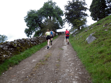
We left my mum’s at 0700 and arrived at Ambleside for breakfast just before 0900. It was a nice leisurely start to the day – coffee and teacakes to help provide energy for the trek ahead. I also wanted to go the ‘Climbers Shop’ to purchase some trek poles. My Raidlight lightweight poles had broken and from the previous recce I had already decided ‘poles’ were an essential item to help on the climbs and decent. It turned out that they didn’t have the poles i wanted; thank god! I ended up with a much better pair and poles that are much more specific for future events. The Leki ‘Traveller’ poles come with a run glove so that you can clip the pole in and out of the hand in a flash. They work brilliantly and I can’t recommend them enough. So, with my poles purchased we moved to Coniston, parked the car and started at about 1100am. This was our first mistake…. you need to start 0700 or 0800 at the latest. Why? Well, quite simply the terrain is so tough that moving quickly just is not possible, particularly when you have ‘full kit’ and 2 ltrs of water on you. Also the rain… oh the rain!

We jogged and speed walked to start with and then hit the first climb which lasted for a few K’s to a car park at Roadhead. Here we headed right to Walna Scar. The rain was coming down but temperatures were pretty mild. We crossed a bridge and then climbed a very stoney strenuous path to the summit of Walna Scar Pass (summit 2106m). We were above the cloud. Pretty darn impressive. We headed downhill, the terrain similar to the other side. Tough, gnarly, rocky and wet. We finally reached a road, turned left and arrived at Seathwaite Village Hall. This would be checkpoint 1 in the L100 with 6.4 miles covered. We looked at each other and both thought wow! This is one seriously tough race.

From the checkpoint we retraced to a small church, opposite was a pathway. We squeezed through the stile and then navigated through woodland, over a bridge and headed for Wallowbarrow. The rain was coming harder and the ground was just boggy. Our feet were permanently wet. Passing through a farmyard we turned right and headed through woods to go around Wallowbarrow Crag on a good path. We took a permissive path and then entered what turned out to be the real ‘low’ of the 4 day trek. A boggy, wet, miserable fell and plantation area signposted to Eskdale. This area was miserable. We had no clear path to follow, the rain was torrential and we were slowly going higher and higher into the cloud and colder temperatures. We finally moved out of the plantation to a rutted, rocky and extremely wet underfoot section. It was hard. So hard, it made Niandi cry (no joke). We were cold, wet and tired and only about 11 miles in to the day. We both look back now and laugh but it was a low point. We pushed on after a little pep talk and at the top we crossed a gulley and found some shelter from a tree. We donned waterproofs, hats and gloves. This worked. It refreshed us and gave us a reason to carry on. One main problem with this sort of trek is that we are carrying minimal kit. I mean minimal. We both had 2 tops, 2 pairs of shorts, 2 pairs of socks, over trousers, waterproof jacket and a pair of ‘skins’ compression tights to sleep in; that was it! One set of kit was now wet and I was thinking how on earth are we going to get this stuff dry…..

We now took a rocky trail and made our way down the other side of the hill. We started to warm up as the rain eased. The terrain was still ridiculously difficult to navigate. The trekking poles proved an invaluable purchase as they provided that extra help and support to help keep us both upright. We arrived at Penny Hill Farm, took a permissive path and rejoined the main path. We now headed to Boot and had the wonderful site of a Pub. I needed to refill my bottles so it seemed the perfect excuse to grab a coffee, get warm, refuel and then push on. We didn’t hang around, maybe 20 min. Just around the corner was checkpoint 2 for the L100, a small Corn Mill.

From the Corn Mill we pushed uphill and headed over Eskdale Moor to Burnmoor Tarn. Again the ground was sodden and boggy with all the rain. Our feet were going to look like prunes. Heading NNE we followed a path to a wood. Wasdale was now in sight. We headed down the rutted, stoney path. Passed a climbers hut and arrived at Wasdale Campsite. It was now 1830. Our plan had been to reach Buttermere but this was another 6-7 miles away and with failing light, poor conditions we decided to call day 1 to an end. We were relieved. We were also relieved to find out that this campsite had a laundry room. Oh joy! We could get our clothes dry meaning that our following days were going to be far more comfortable.

The joys of trekking come when you have to pitch a tent in the rain, cook dehydrated food and hit the sleeping bag at 2100hrs.

Day 2 Tuesday 24th August – Wasdale to Blencathra Centre (checkpoint 6)

We were so tired we slept like logs despite the wind and rain hitting the tent all night. We awoke at 0600 to make coffee and porridge. We packed up and was on the trail by 0700. Within 1 mile we had to cross a river. Our feet were soaked. We headed to Wasdale Head Inn (checkpoint 3) and proceeded for 200m, through a gate and then started to climb to Gatherstone Beck. We then joined Black Sail Pass and pushed on going constantly up.

The rain came and battered us. Needless to say the terrain was really tough and this was topped off at the top with hale stone. We tried to shelter but it was hopeless. It is so open. We headed down a rocky wet trail. You had to be real careful. Very technical and very wet. You could slip any minute. We finally reached the bottom and crossed the River Liza. We passed Black Sail YHA hut and then climbed again to Scarth Gap.

It wasn’t 0900am and we had already climbed 2437 feet. The sun came out and our trek down from the summit to Buttermere and the Lakeside path was a real treat. We arrived in Buttermere just in time for tea and toast and a refuel of our bottles.

Buttermere Village Hall was checkpoint 4 in the L100, from here we turned right past the Bridge Hotel and then right up Ghyll Wood. We now started to gain height again, the path here was much better under foot and it was far easier to keep a consistent pace. We continued to climb to the summit at Sail Pass. The sun was out and this section was really enjoyable. I made a slight navigational error which meant that we had to do a little rock climbing up a pretty much vertical wall to rejoin the appropriate path.


Niandi was not impressed. At the Col at Barrow Door we took a good path descending all the way down aiming for the right hand side of a small wood. We went through a gate, joined a tarmac road and followed until we arrived in the centre of Braithwaite. St Huthbert’s Church Hall was checkpoint no 5.

From Buttermere we had climbed another 2440ft so now a section of flat road was a welcome relief. I called in a camp site to fill my bottles on the edge of Braithwaite and then we ran along the A66 towards Keswick. It was funny to have cars and people around us. We followed the cycle path and then ran along an old railway track. Passing a Church we then negotiated a few road junctions to take a left up Spoony Green Lane and head towards Skiddaw. Now on the Cumbria Way we started to climb up once again and good paths. After 2km or so we reached a car park. We navigated left and then climbed up and around Whit Beck. The light started to fail even though it was late afternoon and the cloud started to come in. Rain?

We struggled along Lonsdale Crags, crossed a wooden bridge and then took the upper track heading to our end point for the day, Blencathra Centre (checkpoint 6). We had covered another 1548ft making the day total around 5500ft.


Our day didn’t end here though! The L100 route continues east towards Dalemain. I had already done this section and due to time constraints our plan was to head south and pick up the L100 route at Ambleside. I therefore navigated 2 or 3 miles to Burns farm Campsite, east of Keswick and directly south from the Blencathra Centre.

We arrived at the site, pitched the tent, showered and then settled to instant noodles, dried fruit and coffee. Bliss. Today had been quite a tough day. At some point in the morning I had either twisted or banged my left knee. Unfortunately the pain had just got worse during the day. I was a little worried of the implications. I put my ‘skins’ on, took some ibuprofen and hoped for the best.

Day 3 Wednesday 25th August – Burns Farm (Keswick) to Ambleside

Wow, last night was chilly. Niandi slept with the following clothing on inside the sleeping bag: thermal long sleeve North Face top, Gore long sleeve run top, Gore Tex jacket, fleece hat, socks and skins tights. She still said it was cold….. Me, I just got cold….. Of course it rained in the night too.

We were up at 0600 again to porridge and coffee and then left at 0700. Today I was navigating to Ambleside. I had decided that if we got a good start and pushed on we could be in Grasmere for early afternoon and have a treat. A cream tea!

Leaving Burns arm we had a small section of road before following the path signs leading to Low Rigg. It was a lovely morning. Chilly but sunny. We got into climbing straight away and reached the summit pretty quickly. We descended and then took the path climbing up to High Rigg. Terrain underfoot was pretty good. Of course it was wet, boggy, rocky and muddy but we were now used to this. We expected no less.

The sun came over Staybarrow Dodd to the east and the light was fantastic. It illuminated the mountain ranges and showed us the beauty that is the English Lakes. Sheep kept popping up everywhere. They just wanted to be photographed.

From the summit we followed good paths to the south east corner. When we arrived at the road we had a small section to navigate before joining the pathway that goes around Thirlmere. This was a great section.

Good paths, great views and the sun on our backs. It felt like we were in Canada or the Alps.

Pine trees and Lakeland views. Halfway on the path we moved east, crossed the road and then picked up the forest path that runs parallel to the lake. A great section. We had thick forest to navigate through. Apparently this is a Red Squirrel reserve but we didn’t see any.

We now followed the trail that run parallel to the A591 crossing the main road to take the path on the west side of the road. Somehow I missed the official path and navigated south through boggy fields. It wasn’t a problem as we had the clear objective of Grasmere in-front of us. The main issue was the terrain. It was very very boggy. I decided with the help of my gps to move up the fells and rejoin the path.

It was at this point that Niandi stepped forward with her left leg and sunk straight to her waist. My initial laugh was soon stopped as I ran over to stop Niandi singing any further. Her shoe was starting to come off and I could see the panic. Walking poles stuck in the ground, Niandi took my hands and I pulled her out…. I was waiting for the outburst but it didn’t come.

It was actually about 10 mins later when I made her climb over another stone wall to reach the ‘official’ footpath. Back on track we arrived in Grasmere within 20 mins and as promised Niandi and myself had a fantastic cram tea. I can’t tell you how good a cream tea is when you have really earned it.

The break was welcome and we took the western path around Grasmere taking the lake path leading to the climb of Red Bank. This is a really steep climb but over good path and when reaching Loughrigg we had superb views over the whole of the Lakeland range.

We descended down and spent the night at a small campsite near Loughrigg Tarn. It was a simple site and unfortunately had no shower facilities. Thank goodness for ‘wet wipes’. No shower was compensated for with a pub less than 0.5 mile away. Oh the joys of some great pub food and a glass of wine.

Day 4 26th August – Ambleside to Coniston

The coldest night of the week made for very broken sleep. Never good when you have to put clothes on to go to bed. We had no rain but we almost had a frost.

Our tent was covered in so much condensation and dew that it actually appeared as though it had rained. The sun was up and the day was obviously going to be the hottest so far. Porridge for brekkie again.

We started our day with a jacket on, over-trousers, hat and gloves. We walked on roads to the Skelwith Bridge Hotel and then joined the Cumbria Way footpath to Elterwater Village. This pathway was good underfoot and flat. It was easy to make a good pace and in comparison to the previous 3 days it was a walk in the park.

At the village we turned left and took the quarry road eventually joining a footpath on the right. We followed the path and arrived at Chapel Stile and checkpoint 13. It was now pretty warm. Finally we were able to strip down to shorts and top. Summer was here!

We re joined the Cumbria Way and headed through the Langdale Valley. This valley for many IS the Lake District. It is stunning landscape and on a day when god shines his light it looks fantastic. The path is good all the way to the Dungeon Ghyll campsite.

Turning left we took the steep zig zag path leading to the summit at Side Pike Pass. We crossed the road and then took the good trails around Blea Tarn to the south west corner. We were making good time and as I have said previously today was turning out to be easy.

From the tarn we had to navigate across a rough fell with no clear path. As per usual it was bogy. More wet feet ! On arriving at the top corner of the fell we joined the road and ran downhill to Fell Foot Farm. After a small section of road we navigated towards a small white cottage. This was an idyllic scene. The property is owned by the National Trust and is picture postcard material.

Taking the path we climbed up and I took the wrong path….. doh! I took the first right path instead of following the main path to the right. Gps once again proved a real help as this provided me with an exact location and confirmed my error. Having said that, it turned out to be a bonus. It added 2 miles to the day and we got to see a disused mine.

Back on track we moved along good paths to Tiberthwaite car park and checkpoint 14.

We now had approximately 4 miles left and today’s ‘easy’ day showed the kick in the tail. At this point in the L100 you will have now covered ironically 100 miles… yes I know. It’s a 100 mile race BUT it is actually 104. The climb up Tiberthwaite is tough, steep and technical. At this point in the race it must be so demoralising.

Onwards and upwards you cross a stream at the top and then have to navigate across open boggy fell with no clear path. If you were doing this at night it would be very confusing. By taking a SSW direction and just keeping going I finally picked up the main path to then take the tough rocky and technical descent back down Milners Bridge before taking easy roads back to Coniston.

Job done.

Conclusion

Firstly, the 100 mile Lakeland loop is a classic in the making. It is without doubt the toughest course I have ever encountered. Trekking it was a real challenge and very rewarding. To try and run/walk it within 40 hours is a completely different challenge. You have so much to take in to consideration. The course, navigation, weather and basically just having the strength and determination to just keep soldiering on is a challenge in itself. If you plan on doing the 50 or the 100 mile race without doubt take time to recce the route. It will prove invaluable. The road book provided for the race is superb but it is still easy to go wrong. I made a few mistakes, nothing drastic but better to do it in training and then on race day you can just keep moving forward on the correct path. It is also important to remember that you will be on the course at night. If you get the cold and wet weather we had with mist and darkness it could very well be terrifying without a sense of direction.

If you don’t fancy racing, split the course as we did and do it over 4/5 days or why not make the course 4 or 5 separate day trips. It’s a challenge that will prove extremely rewarding.

Kit Recommendations

I am going to recommend kit here that applies to a multi-day trek as I feel that you can edit the list so that you can exclude items that will not be needed for a race.

Rucksac – I chose a waterproof salomon XA running sac with a salomon chest pack. This was absolutely perfect. The waterproof main compartment kept all my kit dry. I didn’t use a camel back but chose to carry 3 x 500ml bottles in the chest pack. This helped balance the weight front and back and made me more comfortable. Also the front pack gave instant access to maps, gps and any other essential items.

Tent – Vaude Ultralite. This was brilliant. I looked at all options and tested many before making a purchase. This tent goes up in 2 mins and is free standing. It pitches with the ‘inner’ already attached and therefore in bad weather you stand a good chance to keep the living area dry. It packs small, is light (but not the lightest) and has plenty of room for two.

GPS – I used a Garmin Oregon with Lake District in 1:25,000 detail. The gps is perfect for finding out your exact location. Also, the race directors provide the full route as waypoints, so, if need be you can navigate the whole race via a handheld device/

Poles – I used Leki ‘Traveller’ poles. I consider these essential.

Sleeping Bag – It needs to pack small, be light and warm. Not an easy combination. I chose a model that did 2 of the 3. Unfortunately warm it wasn’t…. a change required.

Sleep Matt – I didn’t take a sleep matt due to weight but I would recommend one. I found the cold struck through the tent and this added to my cold nights. Thermalite do a range. They are not cheap (ppx £80) but I will get one for next time.

Cooker – Jetboil. The ultimate boiling facility. It packs small, all folds up to a neat package and gives you piping hot water in 2-3 mins.

Food – Light and dehydrated food is the best choice. It’s not cheap but works well for treks of this nature. I took fresh coffee in sealed bags and I had a nifty little device to provide filter coffee. We had instant oats in individual bags for breakfast. Just add hot water and away you go. For snacks I had energy bars, nuts, mixed fruit, cereal bars and other little treats to take while on the route and in the evening. I also had a tube of ‘electrolyte tablets’ to make sure I was hydrated all the time.

Clothing – Make sure you have a waterproof jacket and over trousers with taped seams. If you can afford Gore Tex – get them! I used lightweight long sleeve tops by North face (flight series) as they are a warm, light and extremely functional. I had normal run shorts and long tights made by ‘skins’ for the evening to help my legs recover. I had 2 pairs of socks. Would I take more clothes? Possibly yes. If you get soaking wet or cold you have little option with minimal kit. It is a balancing act.

Shoes – I used Brooks Cascadia Trail shoes. I have tried all the shoes on the market and for me these offered the best compromise. Good on the road, good on the trails and importantly comfortable all day.

Extras – I used a Garmin 310 gps to measure my runs and provide data. I had a Blackberry phone with me as this was ideal for emergency calls or any important emails. I had 2 luxury items – a wind up radio and a ‘power monkey’ solar charger. The solar charger gave my Garmin 310 autonomy over the 4 days and it also allowed me to re-charge my phone.

I could go on with all the other little bits such as folding bowls, cups, ‘sporks’ and all the other little nicks and nacks one can find in camping shops but I feel that finding these items yourself is all part of the fun.